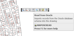
The Oracle Spatial Extension was a tool that enabled AutoCAD Map 3D to push your DWG directly in Oracle. Your Block Definitions, Block Attributes, Object Data and Link Templates were all maintained in Oracle and you could round trip back and forth from Oracle to DWG and back again with a READ/WRITE button.
This extension was added in AutoCAD Map 2000- but only for 32bit.
Those days are past, although if you install 32bit version of AutoCAD Map 3D 2015 you might still get it to run.
Yet I doubt you’ve been able to buy a 32bit computer in any store in the past 5 years.
I talk about it in detail in my AUGI post here: https://www.augi.com/library/highs-and-lows-of-moving-dwg-into-a-database
Luckily there is FDO (Feature Data Objects). This is a generic data connection tool found in products such as AutoCAD Map 3D, InfraWorks, AutoCAD Civil 3D, Autodesk Infrastructure Map Server AND MapGuide.
You can connect to more than just Oracle such as SDF, SHP, SQL Server Spatial, ArcSDE, and almost anything that Safe Software’s FME can connect to with the FDO Provider for FME (http://www.safe.com/solutions/for-applications/autodesk/autodesk-autocad-map-3d/fme-fdo-provider/)
Now there are a few organizations out there that still store their data in OSE (ask them and they don’t want to move since the DWG round tripping to Oracle and back is so seamless). But, now we are in the 64bit world, we may have to move forward.
In this document that I wrote for Autodesk a number of years ago, I talk about moving from Oracle OSE to FDO using AutoCAD Map 3D. The information is still relevant for all those OSE users:
Moving from OSE to FDO with AutoCAD Map 3D
Although the document moves OSE data to Oracle, there is no reason you can’t move OSE data from Oracle to any FDO data source. I have recently used this technique to move OSE data in Oracle to SQL Server Spatial 2012.

